


MARION TWP LINN MAR PCT, Linn County, Iowa
About
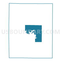
Outline

Summary
| Unique Area Identifier | 582609 |
| Name | MARION TWP LINN MAR PCT |
| County | Linn County |
| State | Iowa |
| Area (square miles) | 50.86 |
| Land Area (square miles) | 50.84 |
| Water Area (square miles) | 0.03 |
| % of Land Area | 99.95 |
| % of Water Area | 0.05 |
| Latitude of the Internal Point | 42.07321260 |
| Longtitude of the Internal Point | -91.55107040 |
Maps


Graphs
Select a template below for downloading or customizing gragh for MARION TWP LINN MAR PCT, Linn County, Iowa


Neighbors
Neighoring Voting District (by Name) Neighboring Voting District on the Map
- BERTRAM TWP Voting District, Linn County, IA
- BROWN TWP W/O SPRINGVILLE Voting District, Linn County, IA
- BUFFALO TWP Voting District, Linn County, IA
- CEDAR RAPIDS PCT 31, Linn County, IA
- LINN TWP Voting District, Linn County, IA
- MAINE TWP PART W/O CENTRAL CITY Voting District, Linn County, IA
- MARION TWP SQUAW CREEK PCT, Linn County, IA
- MARION W2P2, Linn County, IA
- MARION W2P3, Linn County, IA
- MARION W3P3, Linn County, IA
- MARION W4P1, Linn County, IA
- MARION W4P2, Linn County, IA
- MARION W4P3 W/MARION TWP PART, Linn County, IA
- MONROE TWP PCT 2 W/ROBINS PART, Linn County, IA
- OTTER CREEK TWP Voting District, Linn County, IA
- ROBINS PART W/MONROE TWP PART Voting District, Linn County, IA
Top 10 Neighboring County Subdivision (by Population) Neighboring County Subdivision on the Map
- Cedar Rapids city, Linn County, IA (126,326)
- Marion township, Linn County, IA (38,947)
- Monroe township, Linn County, IA (13,020)
- Bertram township, Linn County, IA (2,387)
- Brown township, Linn County, IA (2,095)
- Maine township, Linn County, IA (1,762)
- Otter Creek township, Linn County, IA (1,483)
- Linn township, Linn County, IA (796)
- Buffalo township, Linn County, IA (486)
Top 10 Neighboring Place (by Population) Neighboring Place on the Map
Top 10 Neighboring Unified School District (by Population) Neighboring Unified School District on the Map
- Cedar Rapids Community School District, IA (119,310)
- Linn-Mar Community School District, IA (36,539)
- Mount Vernon Community School District, IA (6,367)
- Alburnett Community School District, IA (3,267)
- Springville Community School District, IA (2,459)
Top 10 Neighboring State Legislative District Lower Chamber (by Population) Neighboring State Legislative District Lower Chamber on the Map
- State House District 36, IA (37,187)
- State House District 35, IA (35,173)
- State House District 29, IA (33,364)
- State House District 37, IA (31,767)
Top 10 Neighboring State Legislative District Upper Chamber (by Population) Neighboring State Legislative District Upper Chamber on the Map
- State Senate District 15, IA (76,152)
- State Senate District 18, IA (72,360)
- State Senate District 19, IA (59,384)
Top 10 Neighboring 111th Congressional District (by Population) Neighboring 111th Congressional District on the Map
Top 10 Neighboring Census Tract (by Population) Neighboring Census Tract on the Map
- Census Tract 1, Linn County, IA (12,535)
- Census Tract 2.06, Linn County, IA (7,563)
- Census Tract 2.03, Linn County, IA (7,536)
- Census Tract 106, Linn County, IA (5,827)
- Census Tract 103, Linn County, IA (3,731)
- Census Tract 105, Linn County, IA (3,625)
- Census Tract 104, Linn County, IA (2,891)
Top 10 Neighboring 5-Digit ZIP Code Tabulation Area (by Population) Neighboring 5-Digit ZIP Code Tabulation Area on the Map
- 52402, IA (40,149)
- 52302, IA (36,980)
- 52403, IA (23,673)
- 52314, IA (5,865)
- 52328, IA (2,826)
- 52336, IA (2,363)
- 52202, IA (1,152)